| Camera Network |
Camera Name |
| HAV |
Vaasa 2-4 |
|
Start |
End |
| Date |
N/A |
N/A |
| Time |
05:15:00 |
18:45:00 |
|
| Run analyses also for each polygon (ROI) separately: True |
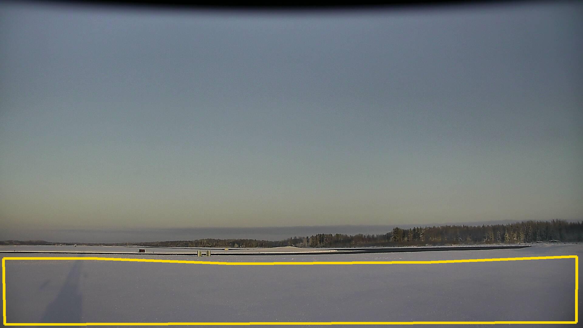
| Polygon | Image Coordinates | | 1 | 0.0061,0.7884,0.0083,0.9892,0.9886,0.9825,0.9894,0.7817,0.7394,0.7992,0.4023,0.8046,0.153,0.7871 |
| ROI Geolocation information |
| Coordinate system: WGS84(EPSG:4326) | | Geometry information is retrieved from camera metadata. |
| Point | Geolocation Coordinates | | 1 | 63.042775,21.765094 |
| Type |
Value |
Minimum |
Maximum |
| Image Threshold |
Brightness |
0.4 |
1.0 |
| Image Threshold |
Luminance |
0.0 |
1.0 |
| Image Threshold |
Red Fraction |
0.0 |
1.0 |
| Image Threshold |
Green Fraction |
0.0 |
0.35 |
| Image Threshold |
Blue Fraction |
0.34 |
0.325 |
| ROI Threshold |
Red Fraction |
0.0 |
1.0 |
| ROI Threshold |
Green Fraction |
0.0 |
1.0 |
| ROI Threshold |
Blue Fraction |
0.0 |
1.0 |
| Pixel Threshold |
Red Channel |
0.0 |
254.0 |
| Pixel Threshold |
Green Channel |
0.0 |
254.0 |
| Pixel Threshold |
Blue Channel |
0.0 |
254.0 |
| Pixel Threshold |
Grey Composite |
0.0 |
254.0 |
|
| Analysis No |
Analysis Name |
Analysis Parameters |
| 1 |
Snow Cover Fraction - SNOWCOV001 |
| Parameter |
Value |
| Include Red Channel |
Not Selected |
| Include Green Channel |
Not Selected |
| Include Blue Channel |
Selected |
| Store mid-step and extra output data |
Not Selected |
| Use georectification |
Not Selected |
| Spatial extent |
0;0;0;0 |
| Spatial Extent Coordinate System |
WGS84(EPSG:4326) |
| Spatial resolution |
1 |
| DEM Dataset |
NLS-DEM2 |
| Camera coordinates |
0;0 |
| Camera coordinate system |
WGS84(EPSG:4326) |
| Camera Height |
10 |
| Horizontal position |
0.0 |
| Target Direction |
0.0 |
| Vertical position |
0.0 |
| Focal length |
24 |
| Scaling factor |
1 |
| Interpolate DEM Data |
Selected |
| Flat terrain |
Not Selected |
| Radial Center |
0.0;0.0 |
| Horizontal coefficient |
0.0 |
| Vertical Coefficient |
0.0 |
|
| 2 |
Snow Cover Fraction - SNOWCOV001 |
| Parameter |
Value |
| Include Red Channel |
Not Selected |
| Include Green Channel |
Not Selected |
| Include Blue Channel |
Selected |
| Store mid-step and extra output data |
Not Selected |
| Use georectification |
Selected |
| Spatial extent |
-70;0;90;110 |
| Spatial Extent Coordinate System |
ETRS-TM35FIN(EPSG:3067) GEOID with Camera at Origin |
| Spatial resolution |
0.01 |
| DEM Dataset |
NLS-DEM2 |
| Camera coordinates |
63.042775;21.765094 |
| Camera coordinate system |
WGS84(EPSG:4326) |
| Camera Height |
3.2 |
| Horizontal position |
-0.2 |
| Target Direction |
8 |
| Vertical position |
-16 |
| Focal length |
50 |
| Scaling factor |
0.5 |
| Interpolate DEM Data |
Selected |
| Flat terrain |
Selected |
| Radial Center |
0.0;0.0 |
| Horizontal coefficient |
0.05 |
| Vertical Coefficient |
0.05 |
|
|